Highlights:
• Fully Built-Out as Standard Retail Space
• Located in-line with other retail
Building Description
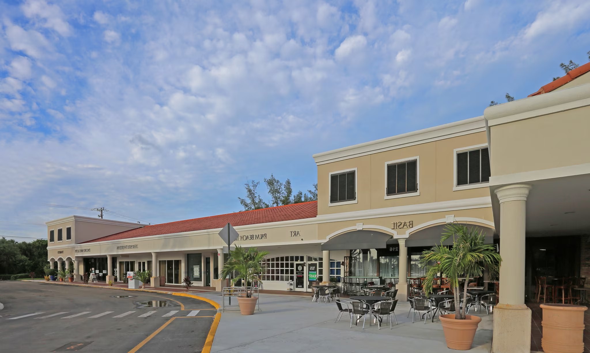
Plaza Del Mar in Manalapan, FL, is a premier shopping destination with many upscale boutiques and dining options. With very limited retail inventory in the local trade area, and combined with its prime location (positioned directly across from the exclusive Eau Palm Beach Resort and Spa), coastal vibe, and immediate surrounding wealthy demographics, Plaza Del Mar is the only opportunity for retailers to enter this highly coveted market.
Air Conditioning
Courtyard
Property Manager on Site
Restaurant
Signage
Signalized Intersection
Tenant Controlled HVAC
Waterfront
Trade-area demographics
Population
2,839
Households
1,671
Median income
$77,697
Median home value
$372,800
Walk Score
40
Trade area (1 / 3 / 5 mi)
1 mi3 mi5 mi
Population6,02865,903184,155
Households3,20825,35867,460
Avg income$150,650$88,870$92,109
Household income (purchasing power)
< $50k40%
$50–100k13%
$100–150k16%
$150k+31%
Traffic count (frontage)
16,000 cars/day (AADT)
Nearby: 16,000 · EAST END BRIDGE 0094 | 14,700 · US-1/SR-5/DIXIE HWY
Neighborhood Demographics · Census Tract 005412
Figures for the census tract this property sits in — the immediate surrounding neighborhood (roughly ½–2 sq. mi). For distance‑based totals, see the 1 / 3 / 5‑mile rings below.
2,839
Population
$77,697
Median Household Income
68
Median Age
1,671
Households
$372,800
Median Home Value
Household Income of 1,671 households
<$50k668 40%
$50–100k222 13%
$100–150k266 16%
$150k+515 31%
Age of 2,839 residents
Under 18139 5%
18–34161 6%
35–54267 9%
55–64617 22%
65+1,655 58%
Trade-Area Rings · Distance from Property
Everyone living within a straight‑line radius of the property — the classic retail trade area. Each ring is cumulative (the 3‑mile total includes the 1‑mile).
1 Mile
6,028
population
3,208 households
$150,650 avg income
3 Miles
67,223
population
25,794 households
$88,830 avg income
5 Miles
190,082
population
69,451 households
$92,774 avg income
Frontage Traffic vs. Palm Beach County's Busiest Roads
This property fronts S Ocean Blvd. Below, its measured daily traffic (FDOT count) is compared to five of the county's busiest roads — I‑95, Florida Turnpike, Okeechobee Blvd, US‑1/Federal Hwy, and Military Trail (approximate peak AADT) — to show how much exposure the location gets.
16,000vehicles / day on S Ocean Blvd (AADT)
I‑95 (interstate)255,000
Florida Turnpike95,000
Okeechobee Blvd62,000
US‑1 / Federal Hwy46,000
Military Trail40,000
◆ S Ocean Blvd16,000
This frontage carries about 6% of I‑95's volume — lighter neighborhood traffic. County roads shown are approximate peak AADT.
FDOT count stations on S Ocean Blvd 16,000 AADT between EAST END BRIDGE 0094 and SR A1A/OCEAN BLVD. (2025) 14,700 AADT between US-1/SR-5/DIXIE HWY and EAST END BRIDGE 0094 (2025) 10,600 AADT (2025)
Risk & Incentives
⚠ Flood Zone AE · SFHA⚠ In Flood Hazard AreaNot an Opportunity Zone
Proximity
✈ Airports
Palm Beach Intl (PBI)7.7 mi
Ft. Lauderdale (FLL)35.9 mi
Miami Intl (MIA)56.5 mi
⚓ Seaports
Port of Palm Beach13.5 mi
Port Everglades34.9 mi
PortMiami56.5 mi
Appraiser Data
Parcel Control No.42434502000010020
Building UseCOMM SHOPPING C
DOR Use Code1600 — SHOPPING CENTER CMMITY
MunicipalityMANALAPAN
Assessed Value$31,247,595
Land Value$14,783,208
Improvement Value$15,906,110
Total Taxable Value$31,247,600
Land UseSHOPPING CENTER CMMITY
Legal Description
2-45-43, S 672.7 FT OF N 1559
Sale History
Sale 1$15,500,000 · 12/2024
Source: Palm Beach County Appraiser Records
Photo
1 / 4
Lease Rate
Upon Request
Extended Unit Specifications
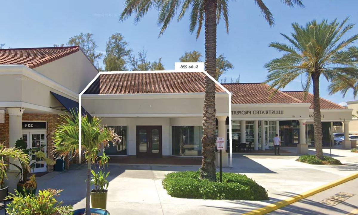
Suite1st Floor, Ste 226
Available—
Clear Height—
Drive-In Bays—
Dock-High Bays—
Office SF—
Restrooms—
Parking Ratio2.84/1,000 SF
Op. Expenses—
Request Information
Listing Courtesy of Ripco Real Estate
Christopher Walther
Ripco Real Estate
More available units in this building · 201-280 S Ocean Blvd