← All Properties Available Warehouse / Distribution

14100 NW 60th Ave — 1st Floor

📍 14100 NW 60th Ave · 1st Floor · Miami Lakes, FL 33014
🚶 Street View Drag to look around · Scroll to zoom
Quick Unit Specs
60,000 SF Sq Ft
Warehouse / Distribution Type
Available Status
Listing Type
$13.95 /SF/YR Lease Rate
$69,750/mo Monthly Rate
Negotiable Lease Terms
Lease Type
Asking Price
Price / SF
Cap Rate
NOI
Partial Build-Out Condition
Power
HVAC
127 spaces Estimated Parking
Yard
Building Specifications
CityMiami Lakes, FL
ZIP Code33014
ZoningIU-C
Year Built1971
Total Building SF213,706 SF
Total Available112,957 SF
Min. Divisible60,000 SF
Lot Size13.18 AC
Clear Height24’
Column Spacing29’ x 45’
Drive-In Bays (building)2 Bays
Parking (building)451 Spaces
ConstructionReinforced Concrete
AmenitiesBus Line; Fenced Lot
Walk Score50/100
Park/Complex14100 NW 60th Ave – 60,000
Space Description & Highlights
Highlights:
• Lease rate does not include utilities, property expenses or building services
• Includes 12,730 SF of dedicated office space
Building Description
Property Overview
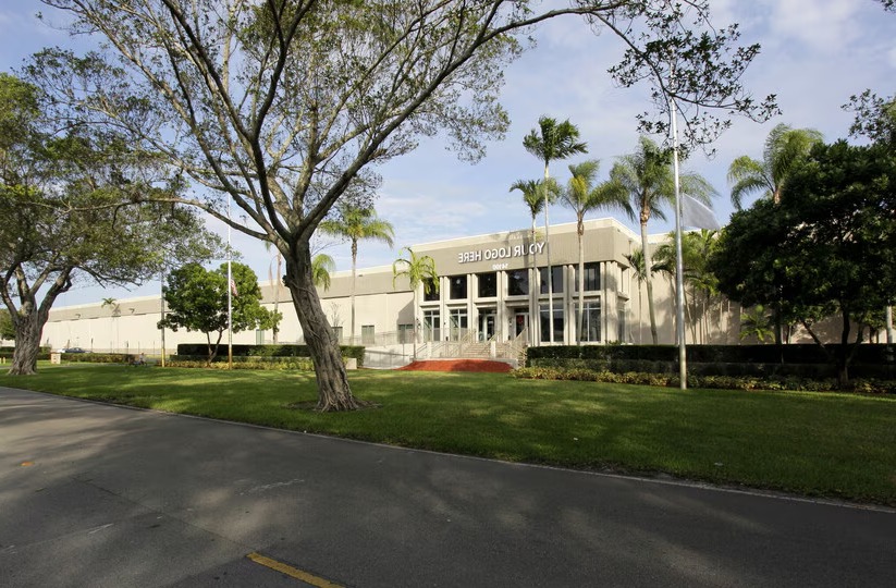
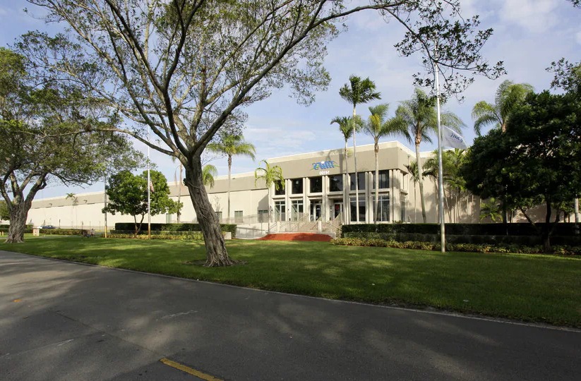
This ±213,706 SF building is situated on a ±13.2-acre site in the heart of the Miami Lakes Industrial Park. It’s located approximately one-half mile west of Opa Locka Executive Airport, ±9 miles north of the Miami International Airport, and ±15 miles northwest of Port Miami. The site is fully fenced.
±213,706 SF Available
±15,175 SF Office Space
±198,531 SF Warehouse Space
36 Dock-High Doors
2 Drive-In Ramps
± 24' Clear Height
ESFR & Standard Wet System
Heavy Power: 2,500 Amps with Backup Generator
Building Dimensions: ± 600' x ± 320'
451 Parking Spaces
Column Spacing: 29' x 45'
Investment Highlights
36 Dock-High Doors ± 24' Clear Height Heavy Power: 2,500 Amps with Backup Generator 2 Drive-In Ramps 451 Parking Spaces
Approved Uses
Every use permitted in IU-1 (EXCEPT adult entertainment per 33-259.1 and private schools/nonpublic educational facilities per 33-151.11), Every use permitted in IU-3 (the enumerated heavy/unlimited manufacturing uses), All other industrial uses similar in character to the above, Utility plants and substations (sewage, water, power, communications, gas), Commuter colleges/universities, NO use is permitted until a use permit is issued under Sec. 33-269 (written application with certified reports; Department + agency review; permitted unless found detrimental to public health/safety/welfare or offensive/obnoxious re odors/gases/dust/noise/vibration/pollution; denial appealable under 33-311(C); no re-application for the same use within 6 months of final denial) (special approval), IU-2-only uses are SPECIFICALLY PROHIBITED in IU-C (special approval), IU-3-type hazardous/unlimited uses remain subject to the same intensity screening consistent with the district's intent (33-267) (special approval)
Labor market & logistics
Labor pool (pop)
5,030
Working age 18–64
64%
Median age
46.5
Median income
$112,578
Logistics — drive distance
FLL airport
19.9 mi
MIA airport
11.2 mi
Workforce age
Under 1817%
18–3419%
35–5428%
55+36%

Neighborhood Demographics · Census Tract 009305

Figures for the census tract this property sits in — the immediate surrounding neighborhood (roughly ½–2 sq. mi). For distance‑based totals, see the 1 / 3 / 5‑mile rings below.
5,030
Population
$112,578
Median Household Income
47
Median Age
1,895
Households
$514,700
Median Home Value
Household Income of 1,895 households
<$50k405 21%
$50–100k475 25%
$100–150k359 19%
$150k+656 35%
Age of 5,030 residents
Under 18851 17%
18–34964 19%
35–541,413 28%
55–64843 17%
65+959 19%

Trade-Area Rings · Distance from Property

Everyone living within a straight‑line radius of the property — the classic retail trade area. Each ring is cumulative (the 3‑mile total includes the 1‑mile).
1 Mile
15,410
population
5,374 households
$83,094 avg income
3 Miles
212,026
population
72,977 households
$75,661 avg income
5 Miles
476,357
population
157,499 households
$75,581 avg income

Frontage Traffic vs. Palm Beach County's Busiest Roads

This property fronts NW 60th Ave. Below, its measured daily traffic (FDOT count) is compared to five of the county's busiest roads — I‑95, Florida Turnpike, Okeechobee Blvd, US‑1/Federal Hwy, and Military Trail (approximate peak AADT) — to show how much exposure the location gets.
65,500vehicles / day on NW 60th Ave (AADT)
I‑95 (interstate) 255,000
Florida Turnpike 95,000
◆ NW 60th Ave 65,500
Okeechobee Blvd 62,000
US‑1 / Federal Hwy 46,000
Military Trail 40,000
This frontage carries about 26% of I‑95's volume — strong major‑arterial exposure. County roads shown are approximate peak AADT.
FDOT count stations on NW 60th Ave
65,500 AADT between END BR 870646 and Bridge No-870721 (2025)
51,500 AADT (2025)
17,600 AADT between UNDERPASS#870467 /NB and SR 823/W 4 AV/RED RD (2025)
13,100 AADT between W 68 ST/NW 122 ST and W 84 ST/NW 138 ST (2025)
Risk & Incentives
🌊 Flood Zone X · minimal ✓ Not in Flood Hazard Not an Opportunity Zone

Proximity
✈ Airports
Palm Beach Intl (PBI) 55.4 mi
Ft. Lauderdale (FLL) 19.9 mi 31 min drive
Miami Intl (MIA) 11.2 mi 22 min drive
⚓ Seaports
Port of Palm Beach 62.4 mi
Port Everglades 16.8 mi
PortMiami 16.3 mi
Lease Rate
$13.95 /SF/YR
Extended Unit Specifications
Suite 1st Floor
Available Now
Clear Height
Drive-In Bays
Dock-High Bays
Office SF 12,730 SF
Restrooms
Parking Ratio 2.11/1,000 SF
Op. Expenses
Request Information
Listing Courtesy of Stream Realty Partners, LP
Steve Medwin
Steve Medwin
Stream Realty Partners, LP